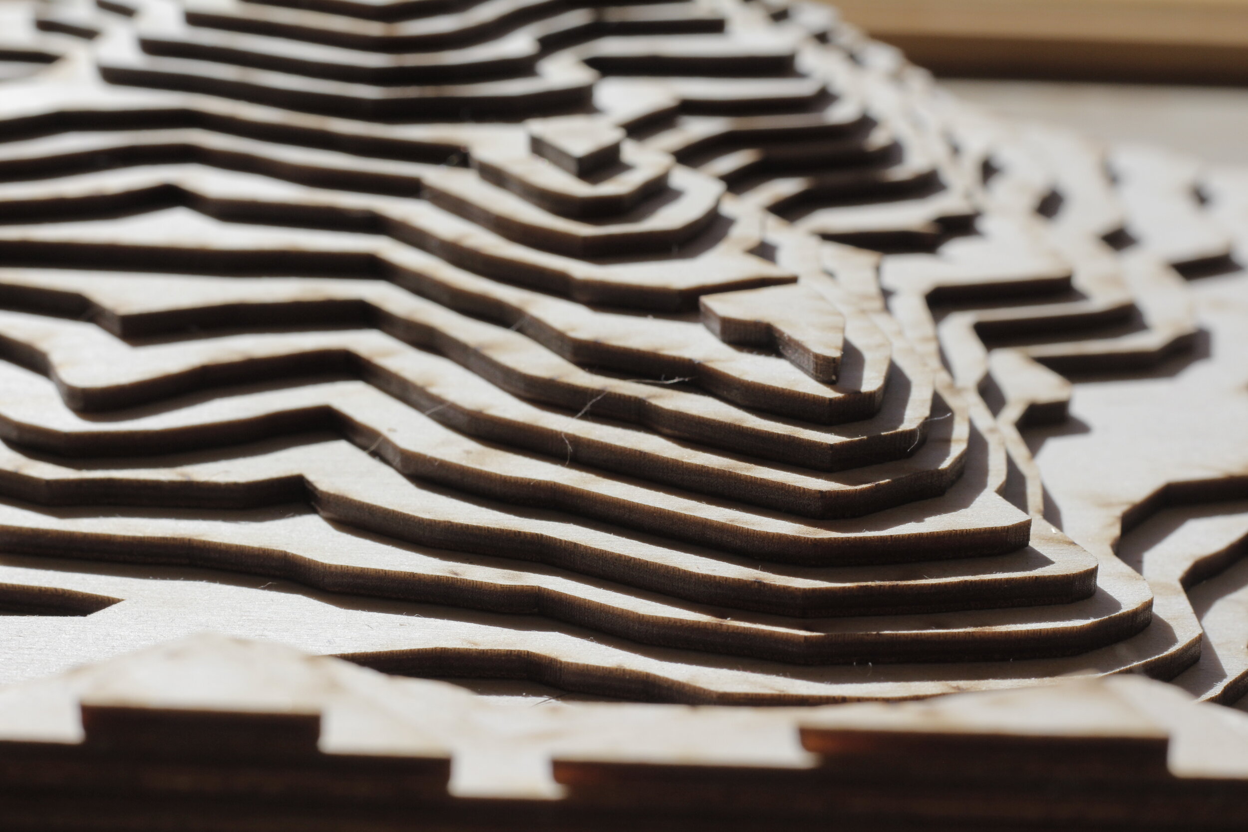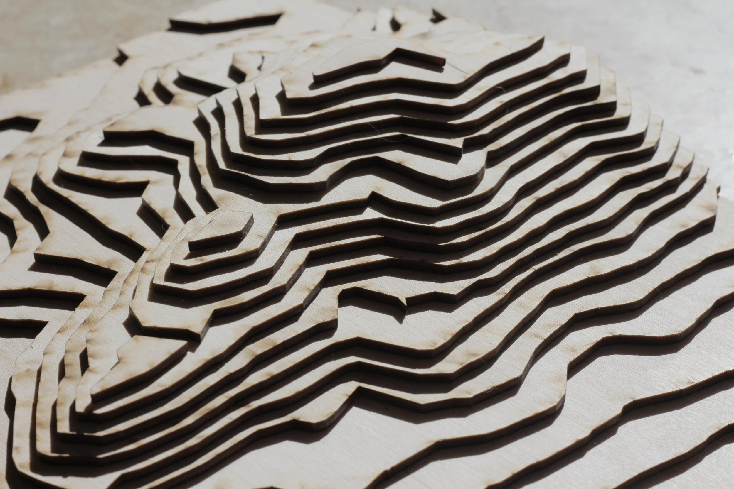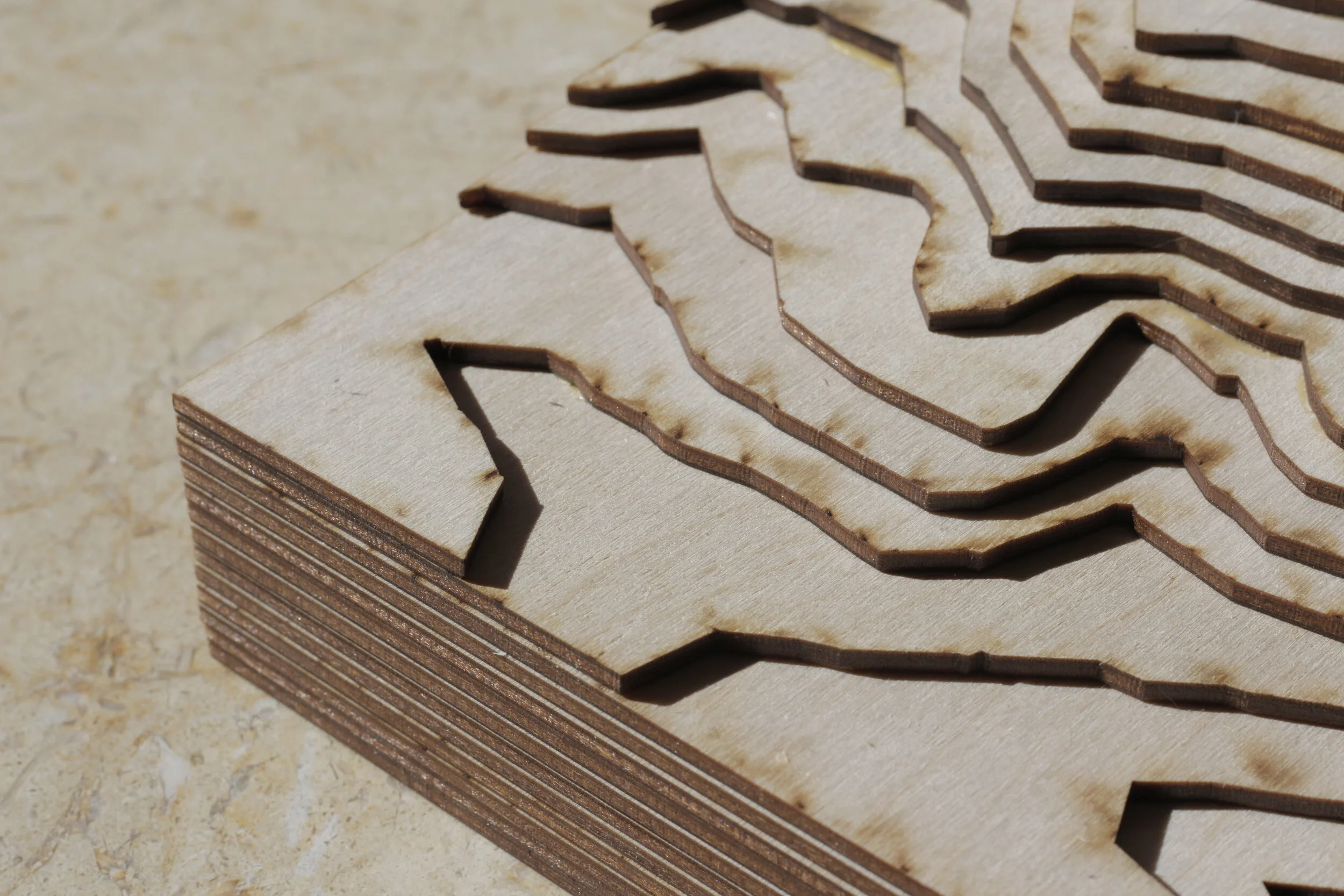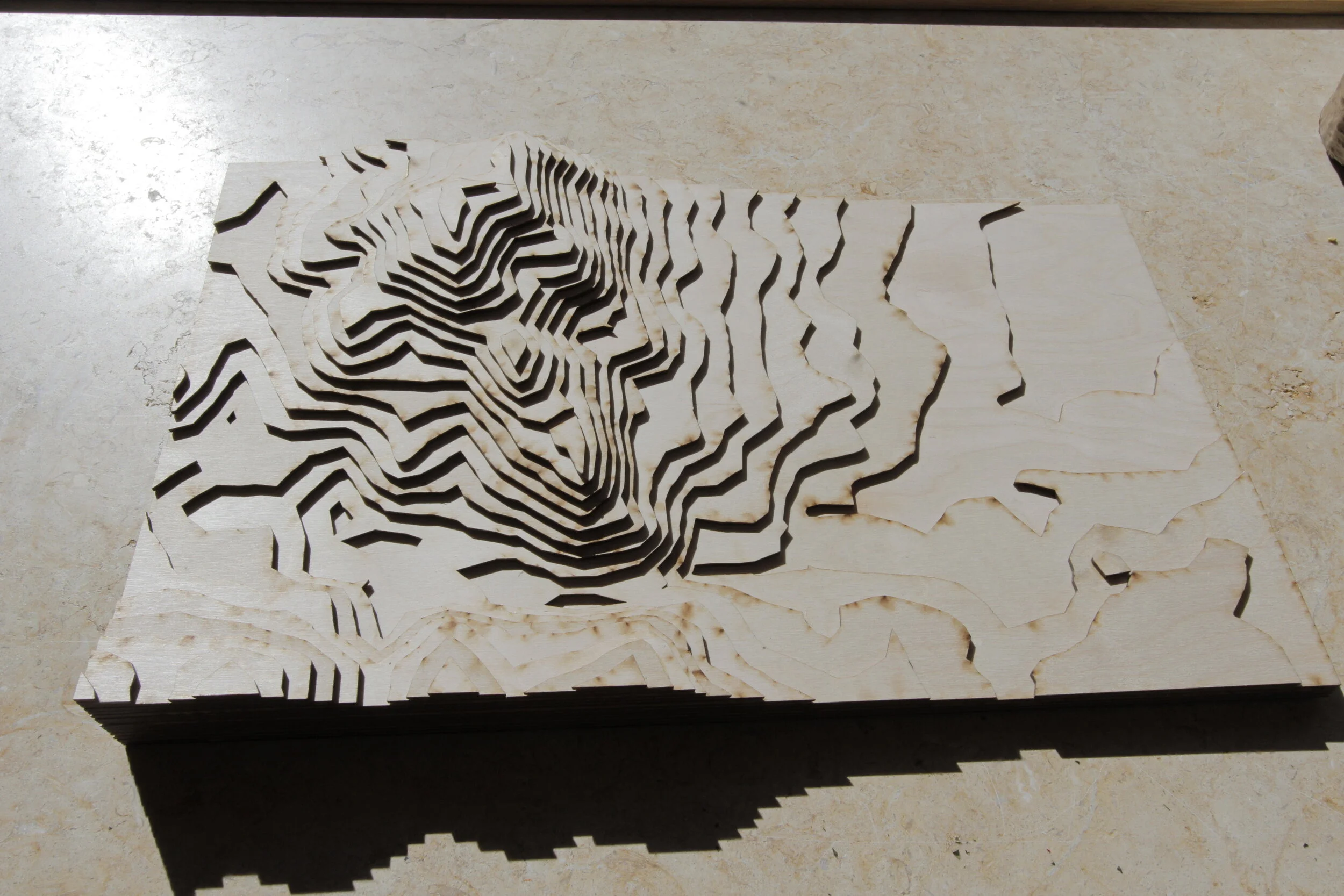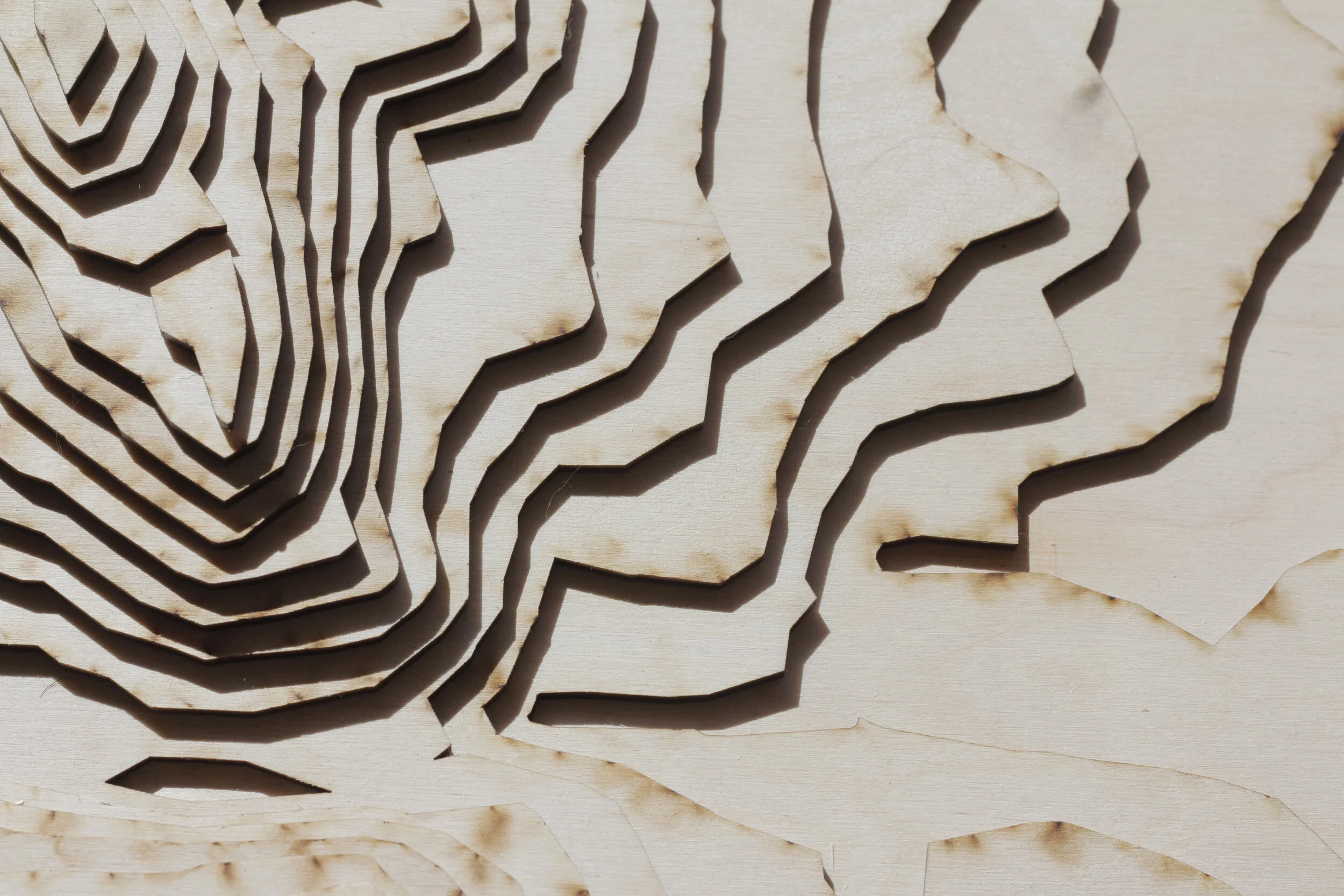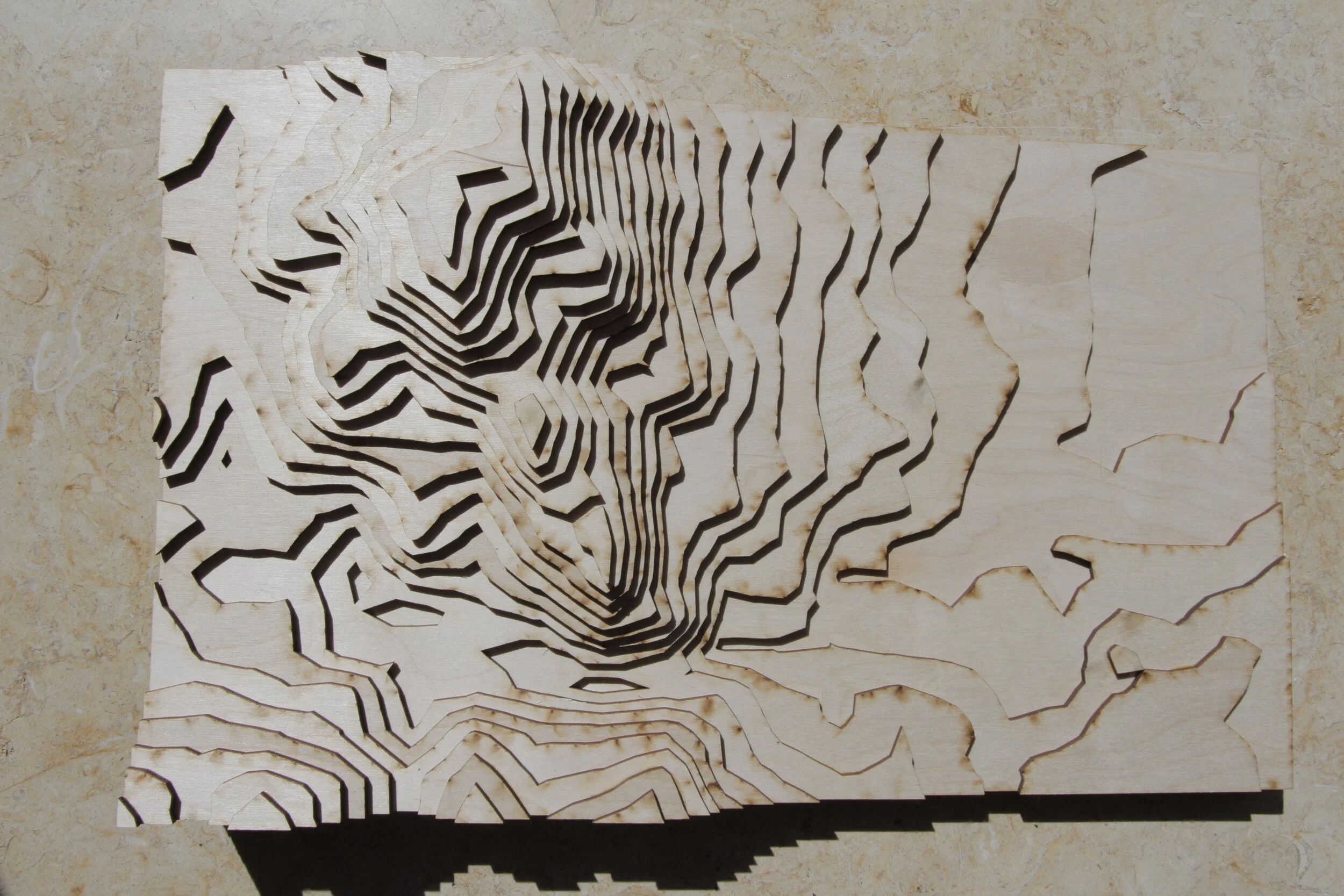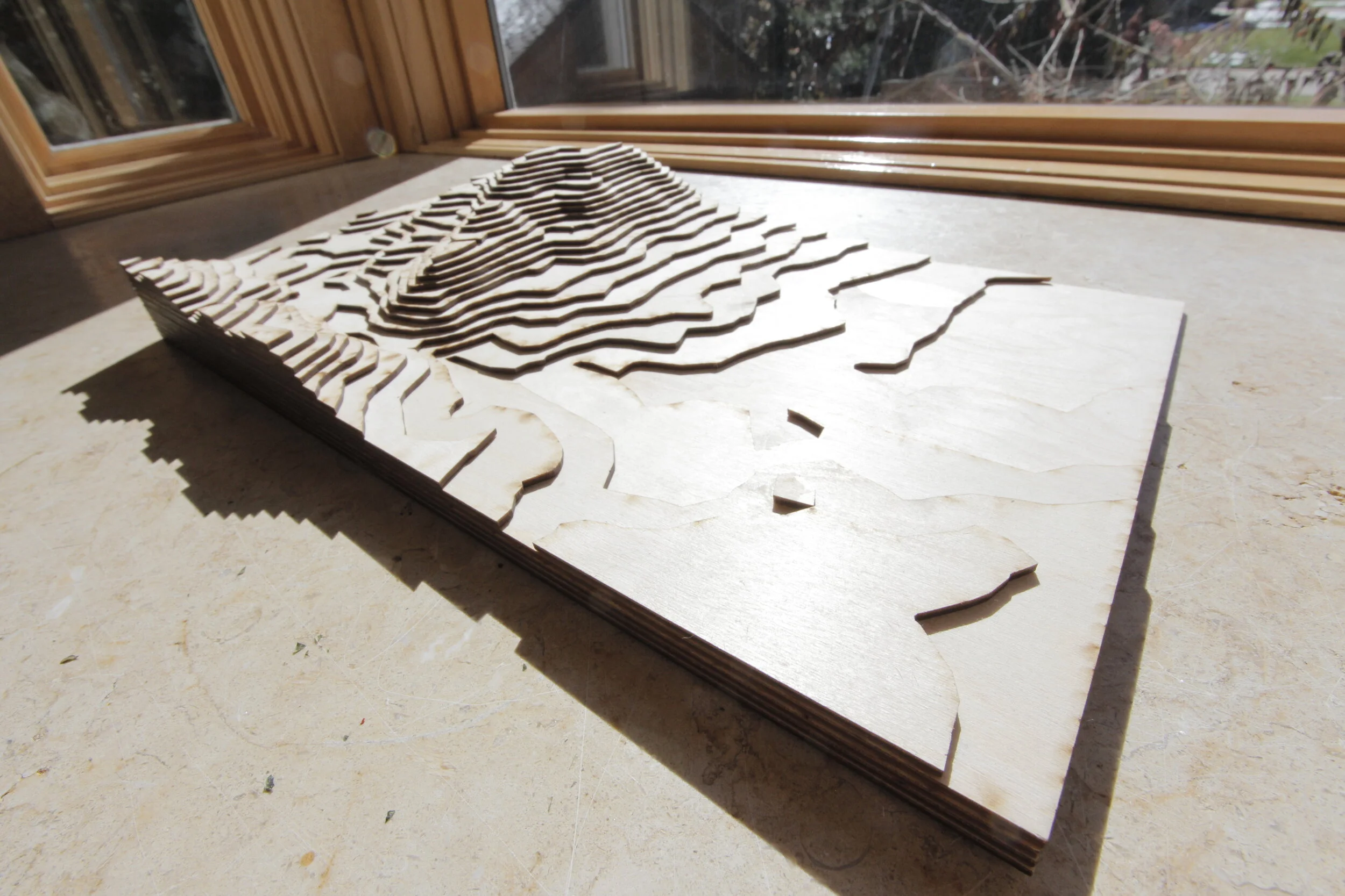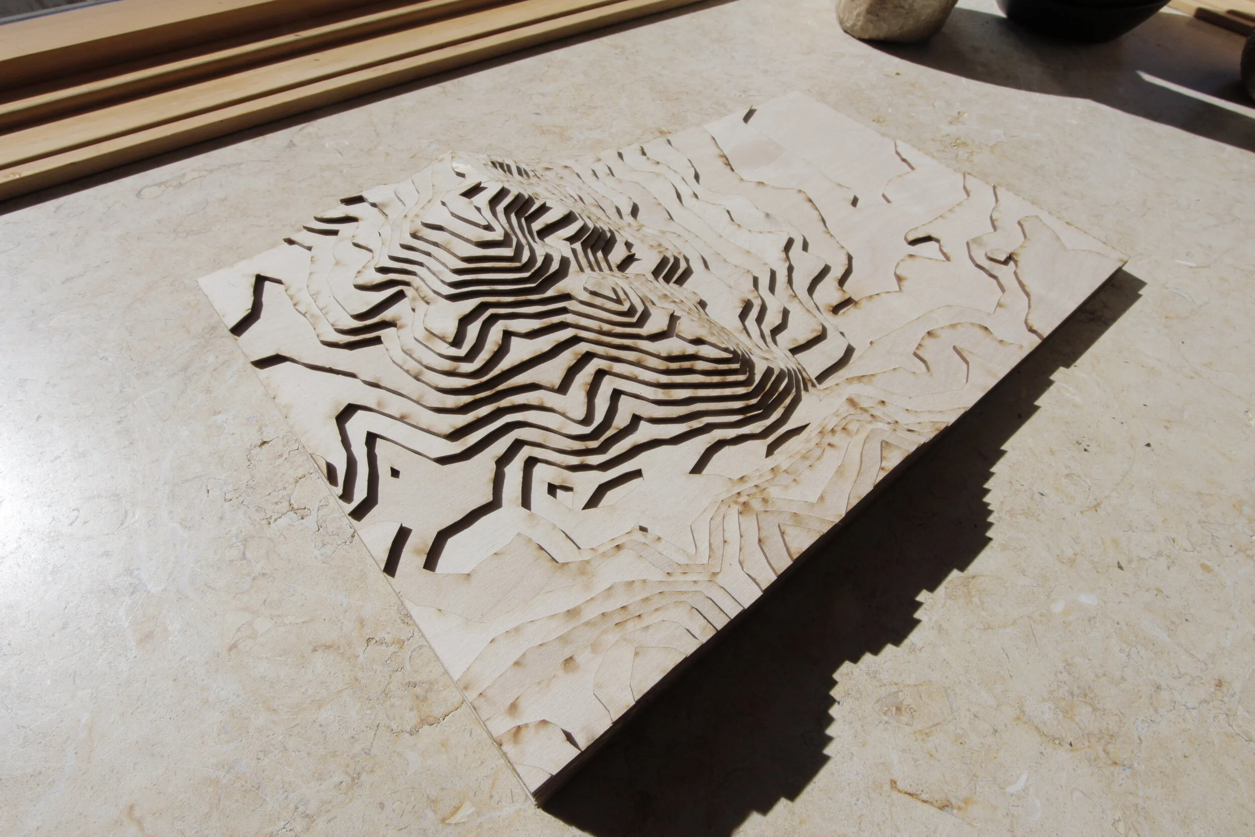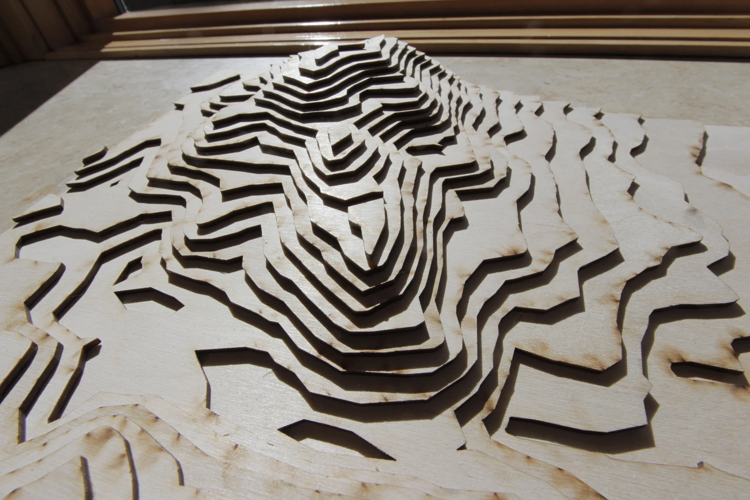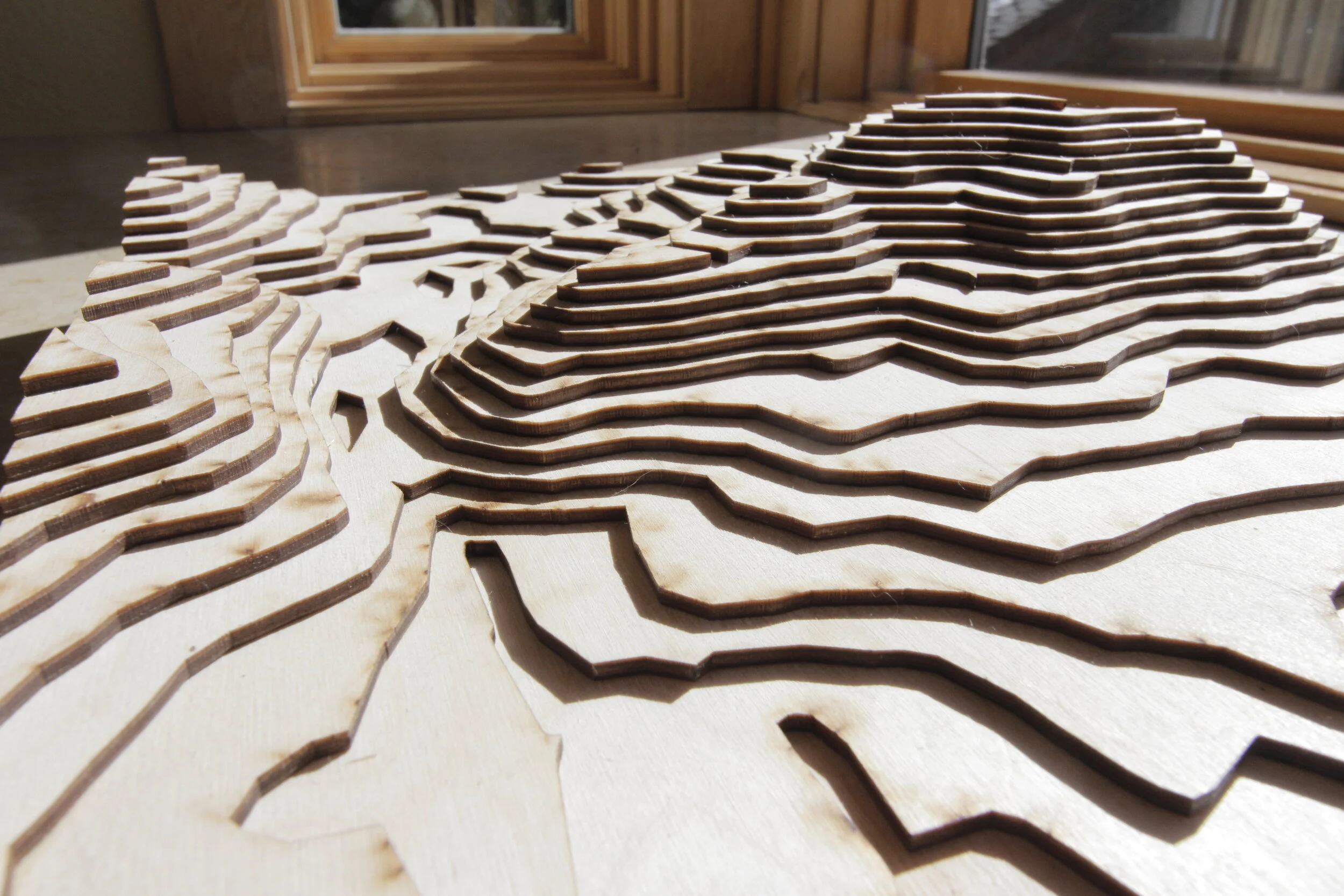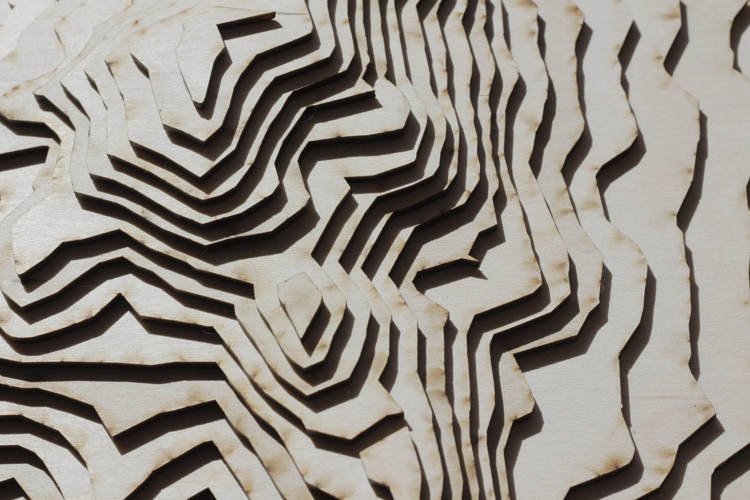
The Colorado rocky mountains rendered in wood layers.
Topology Model - Wood and Laser

A physical representation of geologic contour lines, this piece represents South Boulder Peak and Eldorado Canyon. Each layer corresponds to 130 feet of elevation. 21 total layers range from 5454 ft to 8284 ft.
Made with the municipal laser cutter at building 61. This is a fantastic resource, it’s free, and anyone in Boulder with a library card can use: